Blog

The Infinite Spur

Pete Graham, Ben Silvestre and I had a great trip to the Central Alaska range in May. For all of the details with what’s hopefully lots of useful information see the post expedition report (copy below). See Pete’s blog for his take on the trip, and Trek and Mountain magazine for mine, in an edition soon.

The trip was great, fun times with good friends in beautiful mountains with occasionally adequate weather. Two memories stand out, one from years ago, one from recently. The first is of sitting in a bare room in a Sheffield terrace after a night out clubbing, the techno still raging and people still raving in the sweat-box of a basement downstairs. This being Sheffield and us being young and obsessed the conversation had moved onto dream alpine routes, and I remember Pete and I agreeing that the Moonflower Buttress on Hunter would be the Alaskan objective to go for, writing off the Infinite Spur as just too out there. It’s good to look back and see how perspectives have changed.

The second is of crawling across the glacier back to basecamp, five and a half days out, feeling fully worked. Over the previous hours and days of effort we had shared elation and suffering. Ben had put in a sterling effort putting the track in from our last bivvy, and I had taken over to thread a way between the crevasses back to the safety of our tent. After punching through into thigh deep snow (again), and the last of my sense of humor escaping, we regrouped. Pete gave me his last energy gel and Ben took over, plunging onwards into more knee-deep wading. this moment sums up the way in which trying hard on big, serious alpine routes brings people together, partners digging deep to look after each other in the knowledge that it’s the only way to get over the top and get back together safely.

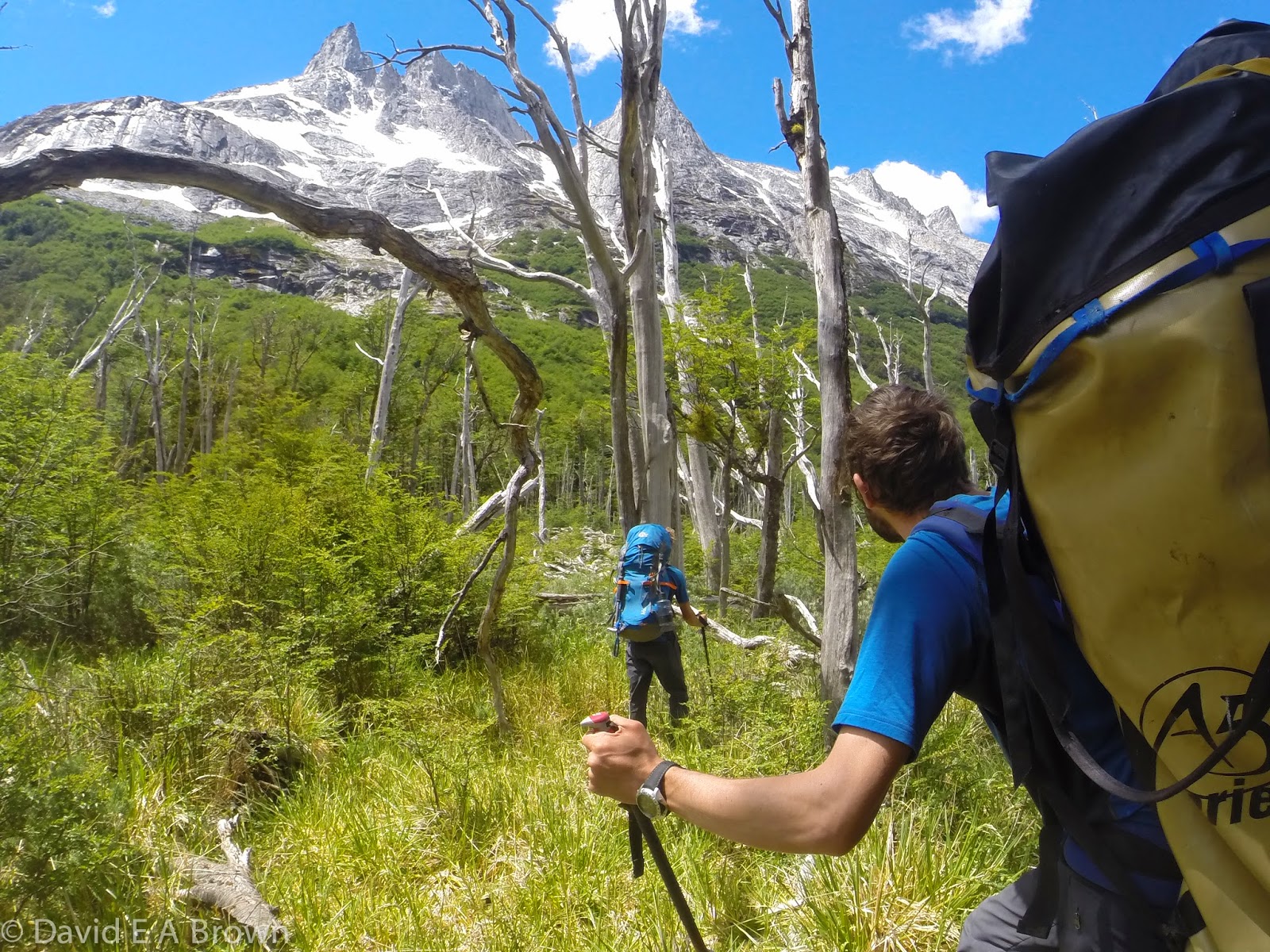
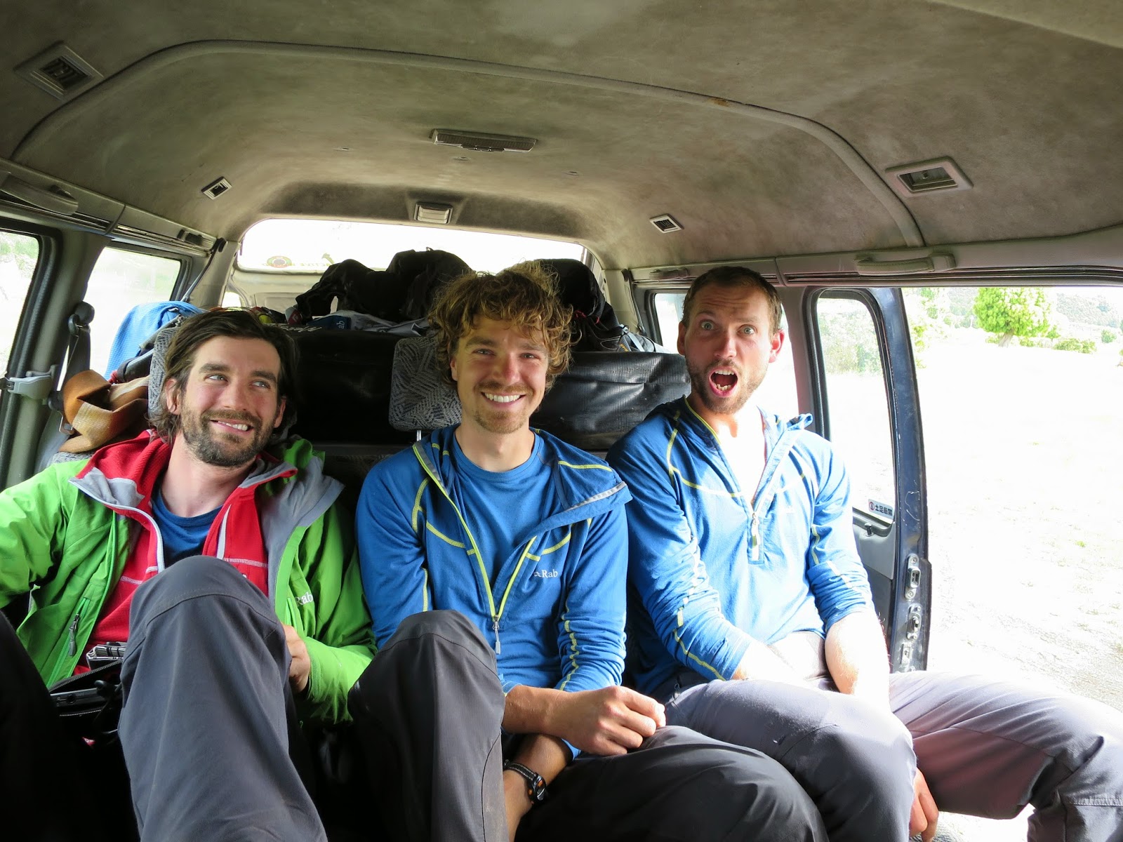
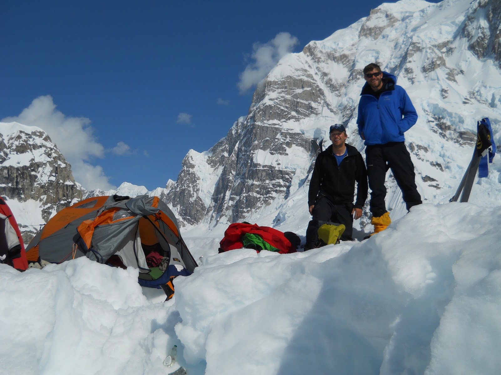
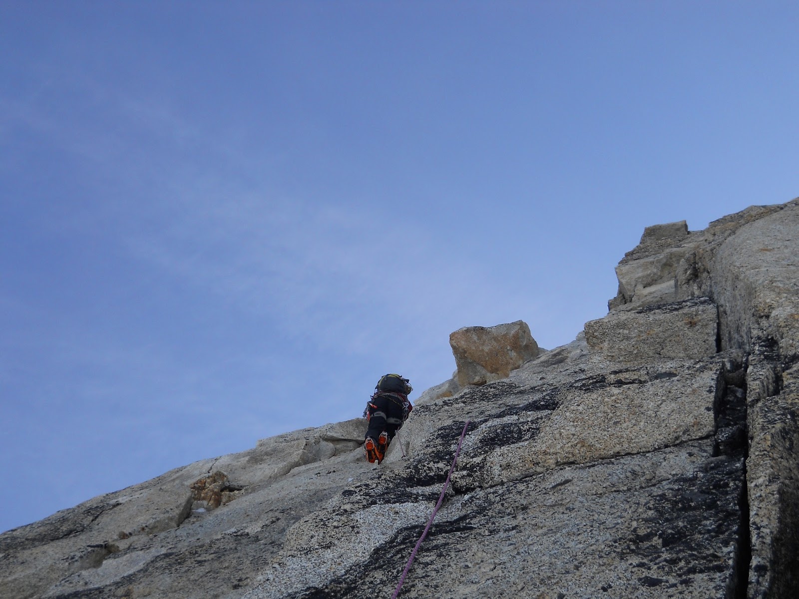
From here I’ll let the photos do the talking.


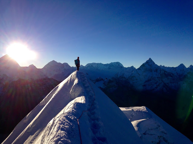
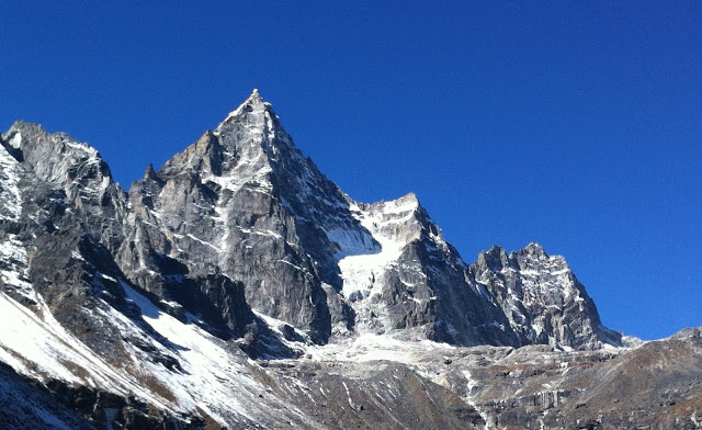
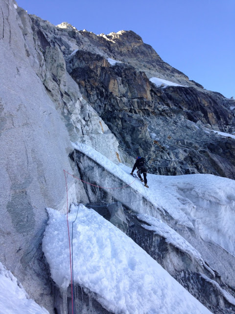
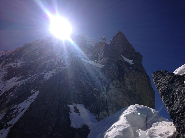
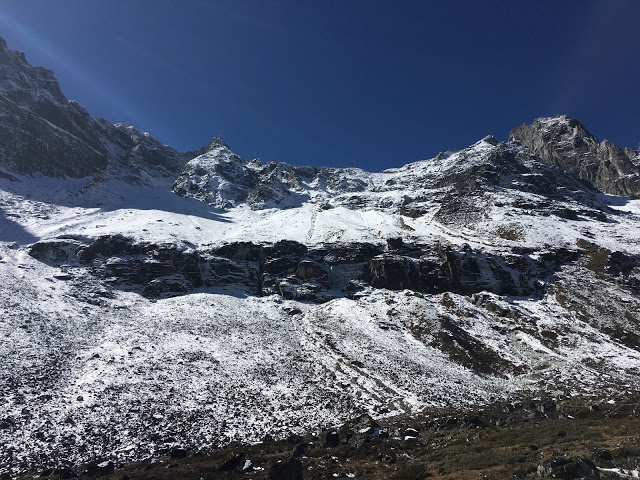
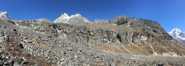
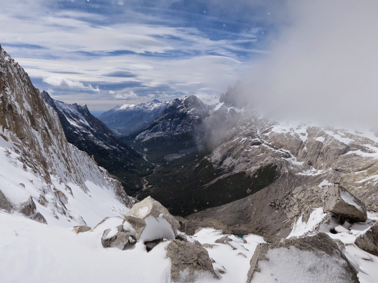
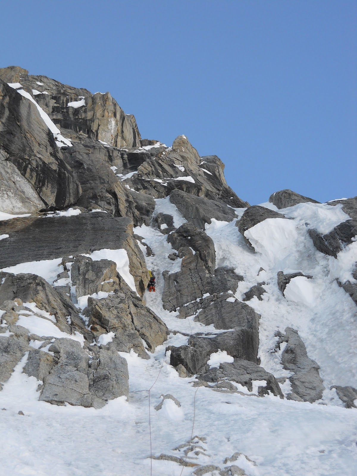
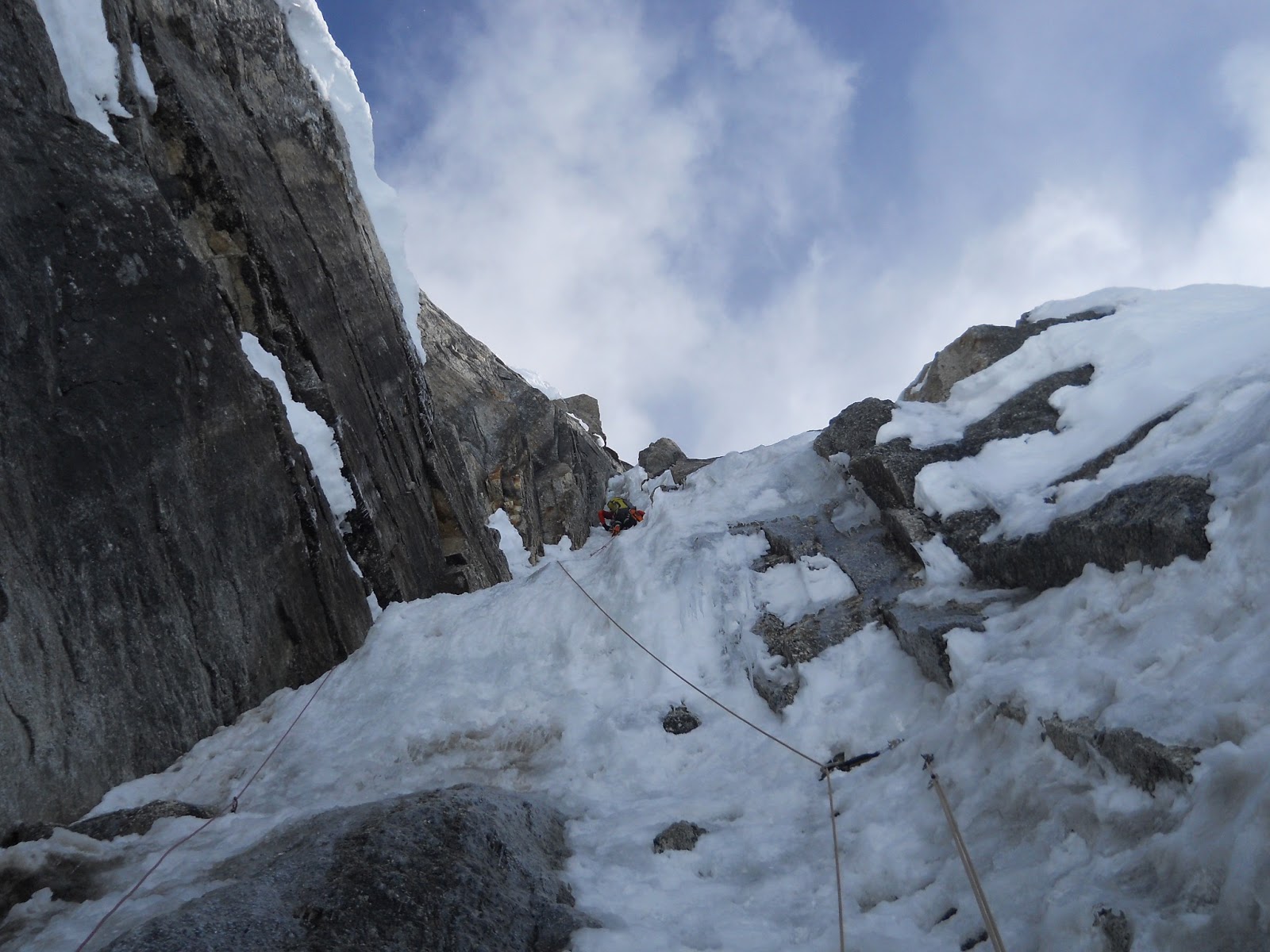
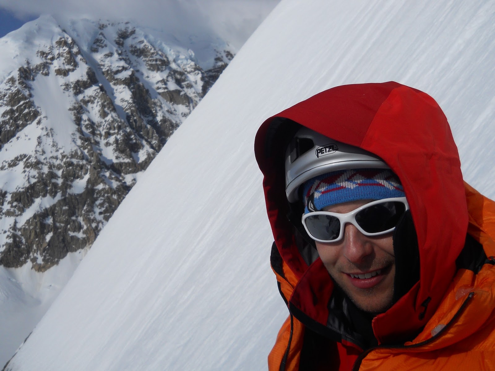
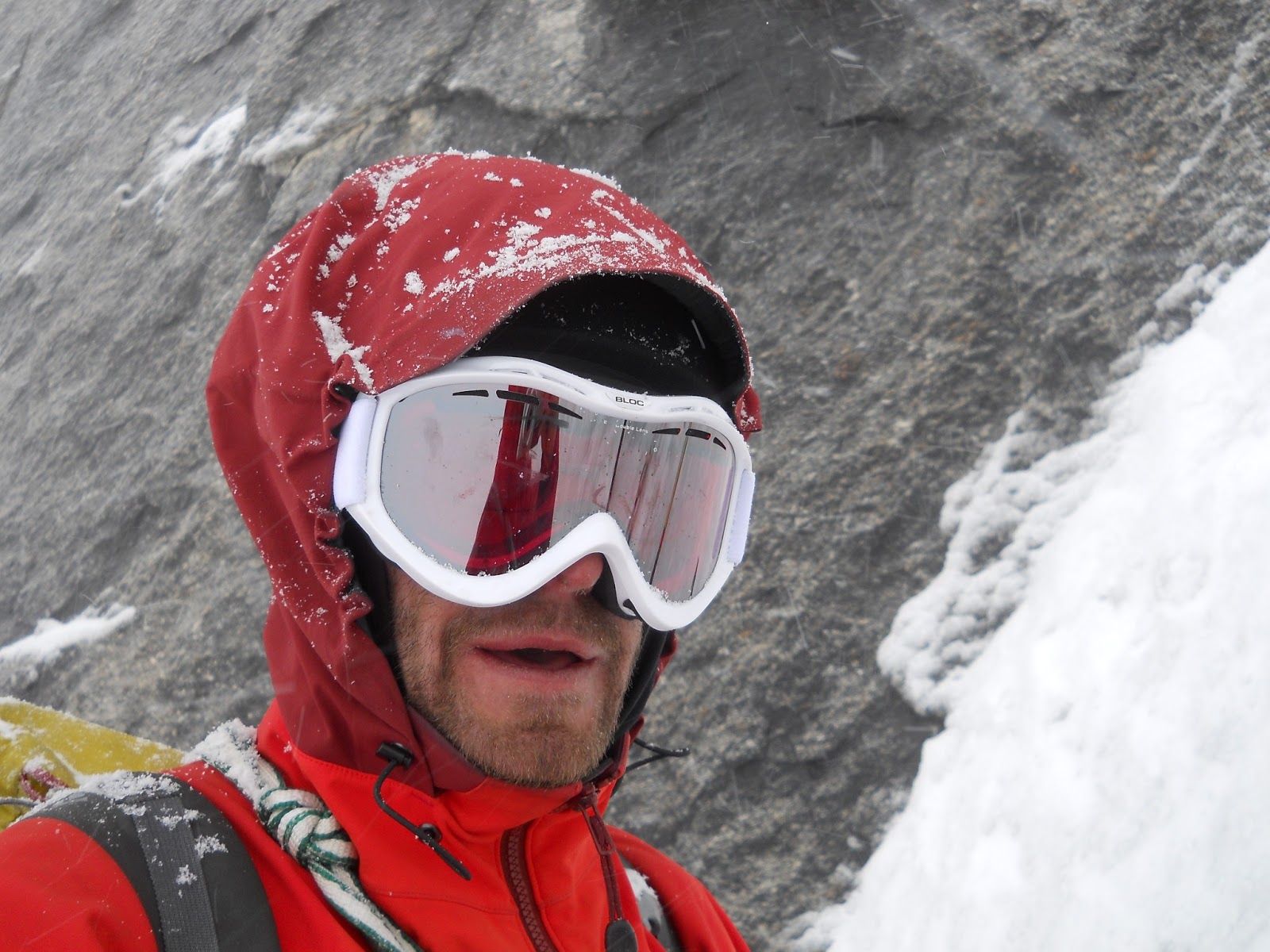
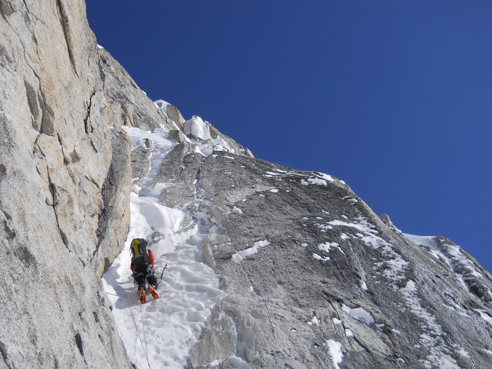
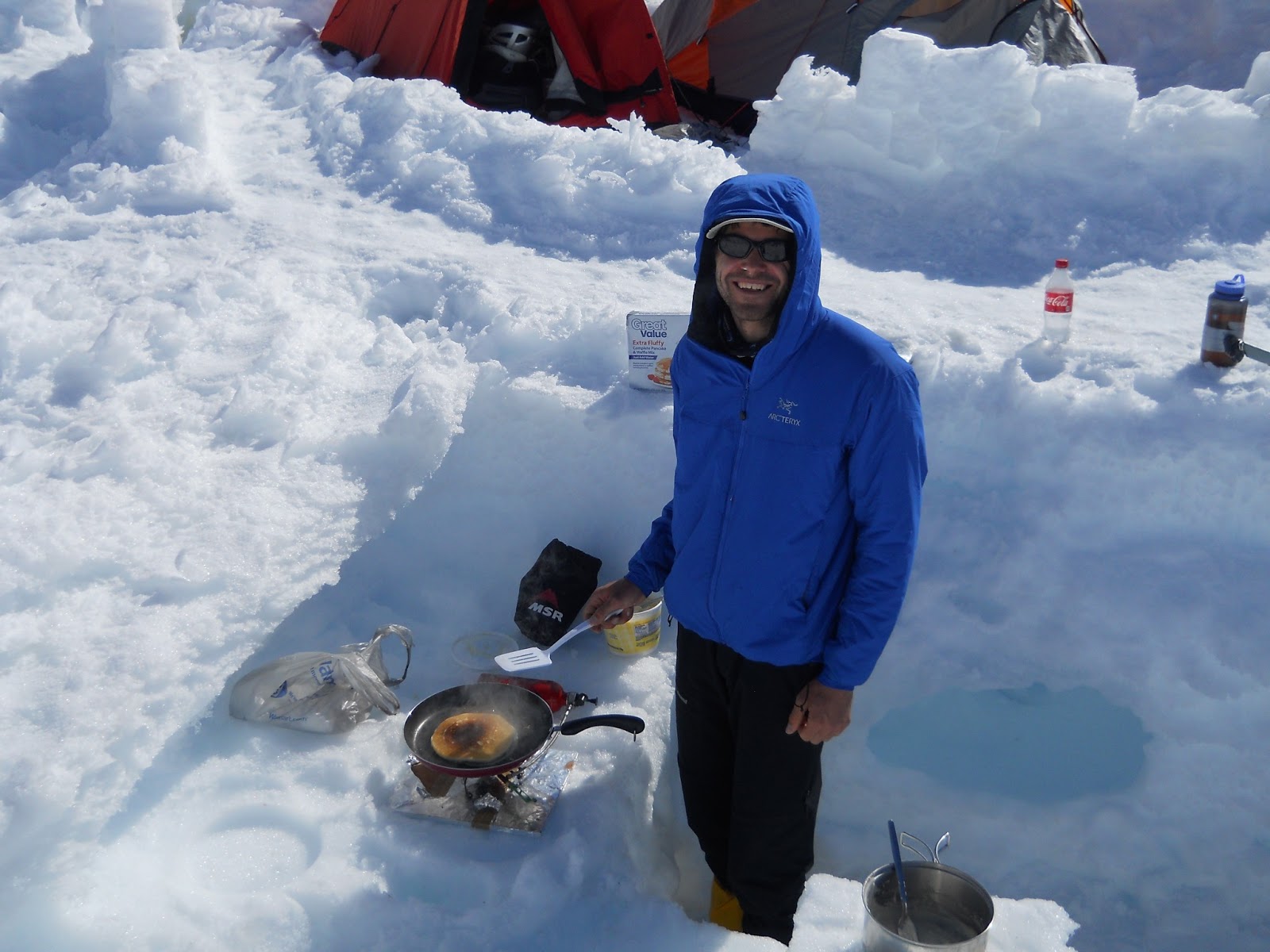
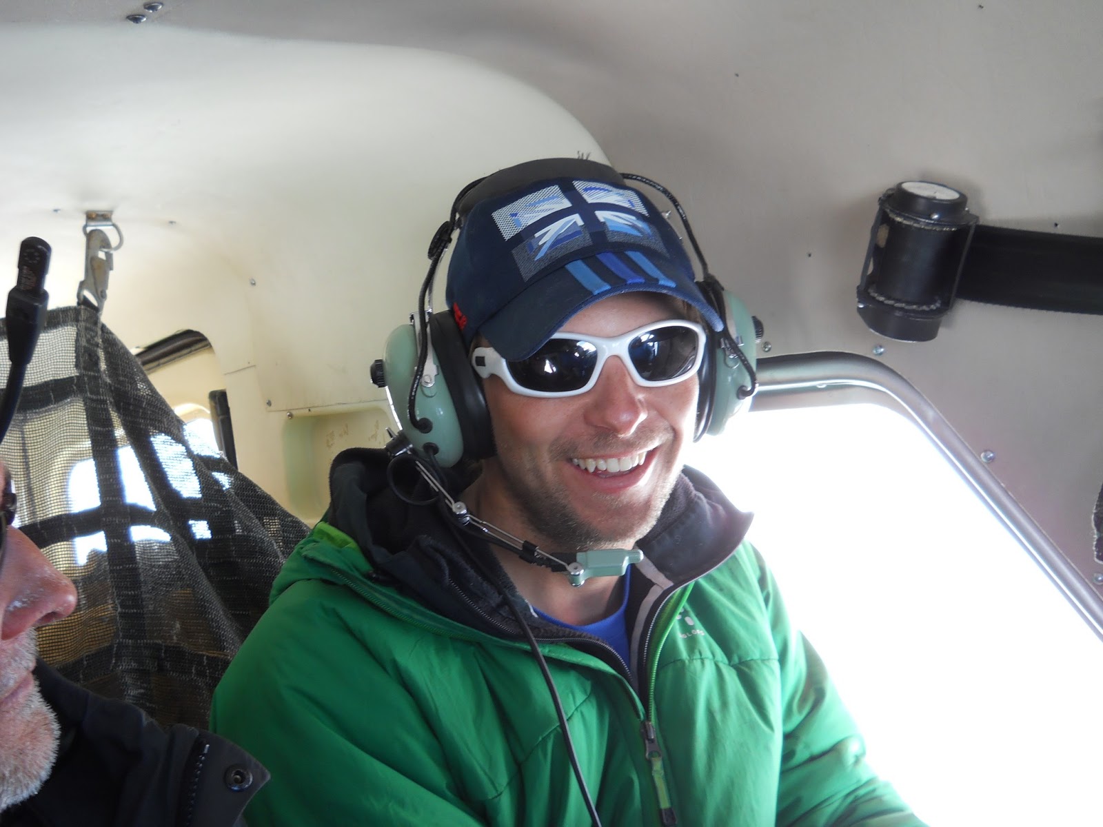
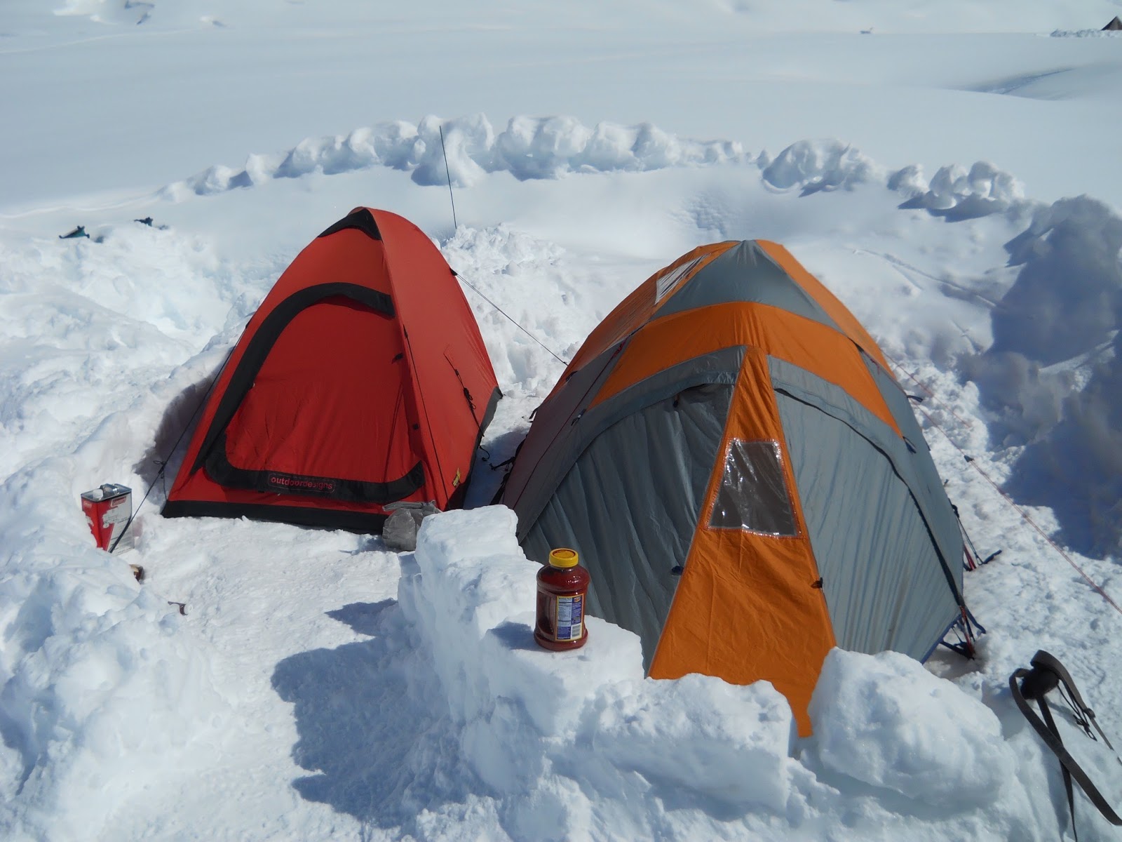
Summit
Post Expedition Report(A little dry but hopefully useful for people planning future trips)

Climbers:

Ben Silvestre, Pete Graham and Will Harris

Summary

We split our expedition into two parts, the first intending to attempt new routes from the Thunder Glacier, and the second acclimatising on Denali’s west buttress before climbing the Infinite Spur on Mount Foraker. We were unsuccessful on the Thunder Glacier, with poor snow conditions and high levels of objective danger preventing all but one attempted line. We succeeded in making the 10th, and 1st british, ascent of the Infinite Spur. We encountered generally poor weather, with very few days of clear good conditions, having only one window of good weather which we used to climb the Spur.

May 2016

2- Arrive in Anchorage

3- Shopping in Anchorage AM, transfer to Talkeetna PM

4- National Parks briefing AM, flew onto Thunder Glacier PM

5- Scouted new routes on Thunder Glacier

6- Snow

7- Attempted new route on Pt 9000’

8- Light snow

9- Light snow

10- Flew from Thunder Glacier to Denali BC/ Kahiltna Glacier. Moved up to 7,800’ on Denali

11- Moved up to 11,000’ camp in poor weather

12- Carried a load to windy corner on west buttress route in poor weather

13- Moved camp up to 14,000’ on west buttress

14- Collected cache from windy corner

15- acclimatisation run to 16,000’

16- Acclimatisation run to 17,000’

17- Rest day

18- Rest day

19- Acclimatisation to 17,000’. Would have liked to go to summit but poor weather.

20- Storm

21- Moved from 14,000’ to base camp

22- Snow

23-snow

24- Packed for the Infinite Spur

25- Approached the Spur in poor weather

26- Climbed to the base of the 2nd rock band on the Infinite Spur

27- Climbed to the top of the Knife edge ridge

28- Summited and descended most of the way to the Sultana ridge

29- Reversed the sultana ridge, descended most of Mt Croson before snow conditions forced us to wait for a refreeze.

30- Descend to BC. Eat and sleep.

31- Rest

June

1- Rest. Pete and Ben collect skis overnight

2- Snowing

3- Snow AM, fly out to Talkeetna late in evening.

Thunder Glacier

We had seen photos of potential new lines to be climbed on Thunder Mountain and on the south face of Hunter South. Unfortunately, whilst we found a number of potentially interesting lines, the entire Thunder cirque is threatened by a ring of high seracs which make much of the climbing unjustifiably dangerous, to our tastes at least. The unclimbed south face of Hunter South looks particularly dangerous, and sadly the unclimbed west face of Mount Providence, whilst impressive, has an objectively dangerous approach. We attempted to make an ascent of what would have been a 750m long mixed line on point 9000’, but were turned back after approximately 350m vertical by unconsolidated powder on rock. Up to here we found technical difficulties up to Scottish grade VI. We considered another possible line on Thunder Mountain itself, but after watching this avalanche opted to move on to the second part of our trip.

We we’re surprised by the snow accumulation on steep faces whilst in the Thunder cirque. When viewed from the summit of Foraker a month later the faces were much drier, perhaps giving potential mixed/rock climbing on Thunder.

Photo: Pt 9000’ on the right, We used the left of centre depression to access the central groove during our unsuccessful attempt.

Photo:  Thunder glacier cirque as seen from the summit ridge of Foraker. Much blacker by the end of May.

Infinite Spur

The Infinite Spur takes a direct line up the chaotic south face of Mount Foraker, soaring 2800m from the Lacuna glacier to the south summit. First climbed by Michael Kennedy and George Lowe over eleven days in June 1977, the route has since gained test-piece status. After a flurry of repeats at the turn of the century, the route received it’s last ascent in 2009 at the hands of the Swiss Anthamatten brothers. Whilst not as technically difficult as the nearby North Buttress of Mount Hunter, it’s scale combined with the lack of easy descent from Mount Foraker’s summit make for a committing venture.

After spending a day approaching the base of the route we crossed the bergschrund early on the morning of May 26th, climbing steep snow and mixed slopes before belaying at the base of the crux M5 mixed pitches. With these dispatched, and the end of Pete’s block, Ben took us up through the first rock band and to our first hacked bivi ledge. The early demise of this ledge saw us up and away before 1am, straight into the second rock band. More quality ice and mixed climbing led us up and onto the ice rib, where we were passed by Colin Haley and Rob Smith, on their way to making a record-breakingly fast ascent of the route. Colin would come back around for a mind-blowing solo of the route a few days later, describing a harrowing storm-bound descent as crossing the line into unacceptable danger. From here, two pitches of South Stack style choss led us through the black band and then to the top of the knife edge ridge, where we chopped an airy bivvy after 24 hours of the go.

After reluctantly climbing out of our two-person sleeping bag the three of us shared the lead up seemingly endless snow and ice slopes, to be confronted with bitingly strong winds on the summit ridge. Luckily the gusts abated and we reached the summit late on May 28th, bathed in golden dusk sunlight for a shared emotional moment, before beginning our descent of the Sultana ridge. After a night spent in a handy sheltered crevasse, and a day traversing the peaks of the Sultana, our precious weather window finally came to an end, leaving us descending Mount Crosson in typically Scottish conditions. A final three-hour bivvy spent waiting for waist-deep slush to refreeze and we were onto the Kahiltna glacier and back to base camp for a late lunch, feeling deeply sated by our intense experience.

Our ascent was the 10th of the route, the 9th completed the day before by Rob and Colin. We were the first Brits to climb the route. The experience of climbing such a big, committing route, has left us wanting more- we are keen to attempt something similar but unclimbed, and with this in mind are already looking towards a trip to Pakistan in 2017.

Accidents/Illness

No accidents/illnesses to report.

Google Earth

Google earth is quite poor for the area visited, particularly the south side of Foraker/ Lacuna glacier, with images too bleached to be of use.

Logistics

Shopping

We shopped for food at Walmart in Anchorage.

Outdoor equipment was purchased from REI and AMH in Anchorage. Wide range of gear available. There is also a second hand gear/consignment store opposite REI that is worth a look.

There’s a great second hand book store, Titlewave, on the same row of shops as REI.

Permits

You must register 60 days in advance to purchase a permit to climb on Denali and Mt Foraker. Before entering the range climbers must attend a briefing session at the Talkeetna ranger station, which we found to be very helpful as our ranger was Mark Westman, who had himself made a previous ascent of the Infinite Spur.

SAT Phone

We hired a SAT phone from Satellite Phone Store, opposite REI.

Anchorage

We stayed at the Arctic Adventure Hostel, which is clean and reasonably priced.

Talkeetna

The roadhouse breakfasts are justifiably famous, as are the fairly wild nights in the Fairview Inn…

Transfer

We used Go Purple Transfers to take us and our baggage from Anchorage to Talkeetna. For the return journey we rented a hire car from Fairbanks, where we visited friends for a few days after completing our climb.

Gas

Gas canisters from REI in Anchorage, white gas for MSR stoves from TAT

Glacier Flights

We flew with Talkeetna Air Taxis. They’re the biggest outfit in the range, and are very friendly and helpful. They have a bunkhouse in Talkeetna that it is free to stay in when in town before and after climbing.

Waste Disposal

All rubbish was flown from the glacier. The National Park provides clean mountain cans for the disposal of human waste, which is then either flown out or deposited in a crevasse depending on location.

Budget

Expedition Costs:
Travel –

2,700 (International flights)

1,500 (Glacier flights, inc. bump from Thunder glacier to Kahiltna Basecamp)

300 (Shuttle between Anchorage and Talkeetna)
Food and Stores – 1,100
Peak Fees and Liaison Officer – 800
Insurance – 1,000
Other and contingency – 300

TOTAL: 7,700

Expedition Income:
Number of Members – 3
Amount of Personal Contributions –  4,450
Details of grants:

BMC – 1,000

MEF – 1,650

AC – 300

AAC – 300

TOTAL: 7,700

Equipment

Tents

We used a three person Mountain Hardwear Trango 3 tent, which seems to be standard issue on Denali. We used a one-two person Black Diamond Hi-light single skin tent on Foraker, which was quite cosy with three people. We also used the fly from an old tent as a cooking shelter whilst at BC.

Sleeping Bags

Whilst climbing the Infinite Spur we shared two lighweight Rab sleeping bags between the three of us, zipping them together to make a large down quilt. For future trips whilst climbing as a three I would consider taking a purpose-made down quilt. We used larger, warmer, individual sleeping bags whilst at BC and on Denali’s West Buttress.

Clothing

We used clothing from various manufacturers, but principally that supplied free of charge by Rab. Layering wise, we tended to use a base layer, fleece, hardshell, synthetic insulated layer, down jacket on the top half, and on the bottom half hard or softshell salopettes with either one or two layers underneath.

Hardware

On the Spur we used two 60m half ropes, 1.5 sets of wires, DMM dragon cams small to large, a few birdbeaks and assorted pegs, 12 quickdraws, 2x 240cm slings for belays when leading in blocks.

Sponsors

We would like to thank Rab, DMM, Crux, Mountain house meals and Chia Charge energy bars for their generous support.

Info

Alaska climbing, Supertopo guidebook, by Joe Puryear

High Alaska, by Jonathan Waterman

Supertopo forum thread for Infinite Spur.
If future teams want any extra info about the above then please feel free to get in touch: will.thomas.harris@gmail.com

Nepal 2015: Kyajo Ri & More…

Jon Gupta and I got back from Nepal at the end of November. We had a great trip, despite not getting to the top of anything of significance. You’ll find a few ramblings about failing on big mountains below, followed by the report that we put together for the Mount Everest Foundation which includes all sorts of useful information about climbing in the Khumbu valley .

 kyajo-ri
Kyajo Ri, a pretty good looking mountain…

Failing on big mountains

I’ve failed on a lot of alpine routes over the years for all sorts of reasons. Sometimes you fail because of conditions, or because it’s too hard, or because you just don’t want it enough. I failed in Patagonia because of the apocalyptic weather. I failed on the North Face of the Dru in winter because we didn’t take big enough gear to get up the snow-chocked wide cracks. I failed on the Super Couloir by not paying attention to the soaring temperatures, and then abseiling like mad to escape the shit raining down on us. I once failed on a route on the Blatiere because my partner and I couldn’t even find the start of it. I felt like we failed on the Colton Macintyre on the north face of the Jorrasses, because even though we got over the top, sketching wildly in a raging storm as we went, being that out of control definitely can’t be success.

A friend of mine summed it up nicely when we were loafing around in Chamonix after yet another beating in the mountains. He noted that there are plenty of routes that we could saunter up, but if you try hard enough routes often enough, then failure will be a familiar companion. I try to be philosophical about it, some of my best days in the mountains have been those when we didn’t make the summit, and these have certainly been the episodes from which I’ve learnt the most. That said, it’s pretty good to get to the top every now and again.

On Kyajo Ri I managed to fail in a totally new and somewhat novel way. After two days spent ascending 700 metres of previously unclimbed snow, ice and rock on the best objective of my career I managed to drop my rucksack. I larks footed a sling to my sack, or so I thought, and clipped it to the belay. As I started to pull in the ropes leading down to Jon I turned to watch in disbelief as my bag sailed through the air, bouncing its way down the mountains impressively large and steep West face. After a quick assessment of the situation, and the realisation that we now lacked a stove with no stove meaning no water, we started abseiling and down climbing.

 running away
Running away again. Jon on one of the last abseils

Trips away to big mountains tend to be expensive, time consuming, cold, scary, potentially dangerous, bad for your technical climbing grade and often without tangible success. However, there’s something about the whole process that is addictive, the adventure, camaraderie, excitement in the planning and pleasure in the recollecting which seem to counterbalance this. I’m already excited for heading back to Alaska in May.

Khumbu new routes 2015 (MEF ref: 16-02)

Climbers: Jon Gupta & Will Harris

Dates: 16 October- 20 November, 2015

Overview

After acclimatising on Lobuche East we attempted Kangshung (6061m) but were thwarted by unseasonable new, unstable snow. We then attempted the unclimbed North-East face and North ridge of Kyajo Ri (6186), climbing approximately 700m of new ground and reaching 5900m before a dropped rucksack forced retreat. We rounded off the trip with three days of icefall climbing in the Machermo Khola, finding good steep ice and the potential for longer Scottish style gully lines.

In our grant application we had stated that we hoped to attempt the (as far as we are aware) unclimbed peak of Chhuphu in the Thame valley, but when we arrived in Kathmandu the permit situation was complicated by the fact that the Ministry of Tourism had just taken over permits from the NMA, and there was apparently chaos at the offices followed by a public holiday. As such, we instead chose what we believed to be unclimbed lines on peaks for which it was easier to get permits. We had hoped to attempt a route on the north face of Pharilapcha, but sadly a lack of snow and ice on the mountain forced us to look elsewhere for objectives.

Itinerary

16/10- Arrived in KTM

17/10- Shopping and packing

18/10- Flew to Lukla, walked to Namche Bazaar (3400m)

19/10- to Kyangjuma (3600m), via Everest hotel (3900m)

20/10- to Pangboche (4000m)

21/10- to Dingboche (4400m), acclimatisation walk to 5100m on hill west of town

22/10- 2nd night in Dingboche, acclimatisation  walk to Chukung Ri, 5550m

23/10- to Lobuche (4800m)

24/10- rest dayin Lobuche/ reccied route to Lobuche high camp

25/10- to Lobuche East high camp (5400m)

26/10- Climbed Lobuche (6100m) to false summit and back to Lobuche village

27/10- to Zongla (4800m)

28/10- over Cho La pass (5300m) and to Kangchung BC (5250m). Reccied Kangchung East Ridge           and stashed gear at 5500m.

29/10- Heavy snow, retreated down to Dragnang (4700m)

30/10- Snowing- stayed at Dragnang

31/10- Weather clearing, walked to Gokyo for lunch (4800m) and returned to Dragnang.

01/11- Rest day at Dragnang waiting for snow to settle

02/11- Walked up to Kangchung BC, retrieved gear from east ridge stsh and moved to below west ridge.

03/11- Attempted Kangchung. Turned back at 5750m due to poor snow conditions and illness in     team. Returned to Dragnag

04/11- Walked to Gokyo (4800m)

05/11- Rest day in Gokyo

06/11- Walked to Machermo (4400m)

07/11- Reccied North Ridge of Kyajo Ri

08/11- Rest day

09/11- Packed and prepared for attempt

10/11- Walk to basecamp at base of Kyajo Ri

11/11- Climb to camp 1 at 5800m on north face.

12/11- Continue climbing the face to the ridge 5900m. Descend back to Machermo

13/11- Rest day

14/11- Rest day

15/11- Ice climbing (Looked at gully)

16/11- Ice climbing

17/11- Ice climbing

18/11- Machermo to Namche

19/11- Namche to Lukla

20/11- Lukla to Kathmandu

Lobuche East

We used Lobuche East to acclimatise for our more technical objectives. It was perfect for this, and was an enjoyable moderate snow climb in its own right. Teams acclimatising for higher objectives often camp on a flat spot at approximately 6000m on the summit ridge.

From Lobuche village (4800m) to high camp (5200m) we took 1.5 hours on a good trail. At high camp there was space for about 8 tents and a few small pools of clean water. Just below high camp is a small lake and another high camp used if ascending from Zongla direction.

We left high camp at 03:00am and passed rock bands and rock slabs to reach crampon point at 04:00am. Here we changed into big boots, crampons, harnesses and roped up before heading on to the glacier. The conditions were good, and we made quick progress to the summit ridge, arriving at sunrise. Terrain was Scottish Grade I/II and we moved together all the way following in the footsteps of previous summiteers (the trail was good). On the route there were some snow stakes in-situ on the steeper sections but no fixed lines. From here a thin ridge leads to the false summit where most people, us included, turned around. The true summit was short ridge traverse away, guarded by unstable-looking cornices.

 1
Lobuche East summit ridge

The descent was straightforward and we took the same route down. We were back at highcamp around 08:30 before packing up and heading back to Lobuche Village for 10:00.

Kangshung, 6068m

We had hoped to attempt Chhuphu, an as far as we are aware unclimbed peak in the Thame valley. With issues in Kathmandu it became apparent that it would not be easy for us to gain a permit for this, so we sought an alternative objective. Richard at the Himalayan Database tipped us off about an ‘unclimbed’ peak, Kangchung, located to the north-west of the Cho La Pass.  The peak was opened for climbing by the Nepali Government in 2014, as part of the 104 new peaks released.

Richard let us know that two permits had been issued for the peak in the previous year, and through Iswari we contacted the agents who arranged the permits and discovered that neither team had been successful. After searching the Himalayan Index and the internet, and finding no records of attempts, we decided to attempt to make an ascent.

We initially recced that east ridge of the mountain, which appeared to be fairly chossy, but worth an attempt. Unseasonal snowfall then made the slabby rock presented by this aspect of the mountain  unattractive. We also looked at the North face from the col on the North east Ridge, but this looked to consist of steep chossy slabs.

 kangchung
Traversing across snow slopes after the ramp

Upon returning to the mountain after the storm we attempted the snowy west ridge, but were turned around by sugary unconsolidated snow on steep ice/neve, giving dangerous conditions. The glacier that approaches the col to the west looked to be in tricky condition, so we avoided this by climbing a scree/snow ramp on the SW flank of the mountain. To access the col, traverse left at the top of the ramp.

We say numerous signs of the passage of previous climbers on the mountain, including cairns and old water bottles. We have subsequently heard of three ascents by the west ridge (all without permits), and one attempt on a route from the glacier to the north.

Late 80’s- ‘Phil’ soloed the West Ridge, finding easy snow slopes

2006- Local guide and Lodge owner from Dragnag climbed the west ridge, apparent finding it very straightforward

2013- An acquaintance of Jon’s summited from the west.

2014- A Czech team were rescued by helicopter whilst attempting to climb from the north side of the mountain.

A note to future potential ascentionists- the rock on this peak appears to be of poor quality.

 3
Kanshung (Right) from the south

Kyajo Ri 6186m

The North ridge looked like a really good unclimbed objective, so we set our sights on the 900m face and sketched a line to the top. A recce a few days earlier found a technical ramp slanting up to the base of the hanging glacier.

 4
Kyajo Ri from Machermo. The right hand skyline is the unclimbed north ridge

We set off from Machermo (4400m) after an early lunch to camp at the base of the route (5250m), with the walk taking 3 hours. There is a small frozen lake with water running out through a stream, where we chose to camp. We employed two porters to carry our climbing equipment to this basecamp.

We used the same start that a Kiwi team took in 2011 on their attempt to climb the North East face, ascending steep ice to the foot of the hanging glacier. This involved two pitches of ice and mixed at around Scottish IV. This appears to be protected from serac fall by a steep rock buttress. From here we traversed left under the glacier, making use of overhanging rock walls to provide protection from ice fall. We justified this route choice as the overhanging rock offered some protection and we were only under the hanging glacier for a few minutes.

From here we ascended steep snow slopes to where it was possible to access the hanging glacier. This proved to be hard work, with deep, unconsolidated snow slowing progress. From the hanging glacier we climbed up a snow couloir to a rock band, which was climbed at VS. From here another pitch of steep snow led to where we chopped a ledge big enough for two-thirds of our small tent, at around 5800m.

 5
Will climbing off the glacier and on the main face at 5700m.

The next day we climbed two pitches of unpleasant powder on slabs/choss, to a nice mixed/rock pitch which led to the North Ridge at approximately 5900m. After leading the first pitch on the ridge, giving the hardest climbing of the route so far (HVS on good granite), Will dropped his rucksack containing lots of equipment, including the stove. Unfortunately we did not have any water, or means of melting snow, so chose to descend. This involved several abseils and lots of down climbing.

 6
Climbing steep mixed ground at 5850m

From our highpoint on the ridge it looked like accessing the summit would involve a few hundred metres of interesting rock ridge, possibly using ledge systems on the NE face to skirt gendarmes. From approximately 6050m it would be possible to move around onto steep snow slopes on the west face which should lead to the summit with greater ease. This should be possible, and would probably give an overall alpine grade of TD/ED, and would be a worthwhile objective for a future expedition.

Lobsang, the lodge owner who we stayed with in Machermo, told us that in the pre-monsoon season the North-East face is often much drier. The rock on the route that we tried was generally pretty good, but elsewhere on the mountain it looked much chossier.

It is worth noting that on Google earth it looks like a ramp system below the sub-peak to the north of Kyajo Ri would give access to the North Ridge. In person this ramp looks to hit steep walls before reaching the Col, so would not provide easy access to the ridge.

 7
Will climbing the first HVS/ A1 pitch at 5900m

Machermo Ice climbs

We climbed four icefalls on the shady North-West aspect on the Machermo valley, up to 70m in length and at WI3 to WI4, located at approximately 4750m. We also attempted a gully starting at 5000m on the same aspect, which looked to give good Scottish style climbing. After 30m of climbing on this line we retreated in the face of scarily heavy spindrift. Lobsang Sherpa, from ‘Lodge in Machermo’ showed us pictures of other longer, steeper ice lines which form in the valley during winter, which look excellent and are unclimbed, as far as we are aware.

 8
The main cliff band with many ice falls. North East facing
 9
The south-west facing cliff band with water marks of the icefalls. 150M+
 10
Jon leading one of the waterfalls at WI3+

Mountain Observations

Pharilapcha

We had hoped to attempt a route on Pharilapcha, but unfortunately this mountain appeared to be much drier than in Photo’s we had seen from previous years. The North Face was covered with powder when we arrived in Gokyo, but this soon sloughed off to reveal blank looking rocky sections on the unclimbed central line that we had hoped to attempt. Our experiences on the nearby Kyajo Ri make me think that the line would probably be more powder on steep rock than ice climbing- future parties considering an attempt on this unclimbed route should perhaps bear this in mind. The south face was particularly dry, and looked extremely chossy, with what appeared to be scree where previous ascentionists have found snow and ice.

 11
Pharilapcha South Face

Notes

Agent

We used Himalayan Guides. Iswari Paudel who runs the company was very helpful. They collected us from the airport, arranged flights to Lukla, sorted out permits etc. Using an agent is relatively inexpensive and massively reduces faff.

Permits

When we arrived in Kathmandu the government had that day removed the authority to issue permits from the Nepali Mountaineering Association. This had caused a little chaos, and no permits were being issued. This was easily resolved by Iswari arranging permits fr us once we had left for the Khumbu, and emailed them through to us. This was very convenient, as it allowed us to gain permits for peaks once we had assessed conditions in person. Permits for peaks below 6500m are $125 per person in the post monsoon season.

On returning to Kathmandu Jon attended a debrief session at the ministry of tourism, involving answering a few questions about our climbs and signing numerous pieces of paper.

Porters

Porters were organised as we went.

  • We sent our bags straight from Lukla to Lobuche. This was organised through Paradise Lodge in Lukla, 6 days at 1400 Rs a day.
  • We sent one bag from Lobuche to Gokyo, one to Kangchung BC- 5000Rs per porter. This was pre-organised by Kame Nuru Sherpa in Pangboche
  • From Gokyo to Machermo with one porter (heavy bag) was 2000Rs
  • One bag was transported from Dragnang to Machermo by Yak, free of change by Tashi the owner at Mountain Paradise Lodge.
  • All bags were portered from Machermo to Lukla at 1400rs per day.

Weather

With the exception of the three day snow storm we unluckily had during the middle of our trip the weather was generally very stable. Typically we had clear, crisp mornings followed by cloudy afternoons. It got noticably colder towards the end of our trip.

Gas

We purchased gas canisers (750 Rs each) from Kame Nuru Sherpa, a logistics organiser in Digboche. Canisters can also be purchased in Lukla or Namche.

Internet and Telephone

Internet is widely available in Teahouses, for between 500-1000Rs a day. We purchased a Nepali Sim card and found sporadic service in the Khumbu Valley. A five minute call to a french mobile phone cost 25Rs!

Exchange rate

In Kathmandu the exchange rate was £1: 157 Rupees/ $1: 100 Rs

Tea Houses

We stayed in tea houses throughout our trip. These were cheap, averaging around $20 pp. Including all food. This gives a very luxurious experience compared to expeditions based in tents, but removes the attraction of enjoying a wilderness experience.

Tea Houses used:

Namche

Kyangjuma- Ama Dablam View Lodge- Good food

Pangboche- Sonam Lodge- excellent Chicken Chili

Dingboche- Green Inn/ Moma’s Bakery- Very friendy

Lobuche- Peak 15- Very helpful and friendly

Zongla-

Dragnang- Mountain Paradise- Warm, Modern place

Gokyo- Fitz Roy Inn- Lovely place, highly recommended. Warm rooms, good food, hot showers etc.

Machermo- The Lodge at Machermo- Nice place. The owner, Lobsang Sherpa, is knowledgable about local climbing and was very helpful. The Dal Baht with meat was the best in the Khumbu.

Lukla- Paradise Lode. Really nice and linked with Iswari of Himalayan Guides. Helped sort out Lukla flights and airport faff.

Equipment

Tent: We carried a single skin tent to use whilst climbing. We borrowed a Rab Latok 3, which was perfect for this.

Stove: We used a Jetboil. Gas canisters are easily available. A home-made copper heat transferrer was used in cold weather.

Clothing: For peaks up to 6000m same as in the Alps in spring, with an extra warm layer. Jon’s clothing was supplied by Montane, Will used a mixture of brands.

Waste disposal

We ensured that all rubbish generated on climbs was carried back to be disposed of with other waste generated at teahouses.

Illness/ Injuries

Neither of us sustained any injuries, but we both came down with a cold & cough which forced us to take several rest days between attempting Kangshung and Kyajo Ri.

Expedition expenditure:

9. Budget
Expedition Costs £ Expedition Income £
Travel to and from country 1200 Number of members: 2 1200
Travel within country: 575 Grants:

BMC- 650

MEF- 750

Alpine Club- 350

1750
Peak fees and Liaison Officer expenses if appropriate: 500
Porters: 220
Food and accommodation in country: 1200
Insurance costs: 200
Miscellaneous (details and costs):

Visas- 135

Agent fee- 135

270 Other sources:
TOTAL: 4145 TOTAL: 4145

Avellano towers: Northern Patagonia, 2014

There is a British tradition of assessing the success of a trip by calculating the feet climbed per pence spent.  Our expedition to the Avellano Towers wouldn’t fair well if assessed in such a manner, and would probably fair worse if miles travelled or distance walked was substituted for expenditure. In fact, an alternative title for this article could be ‘Not big wall climbing in Patagonia’ due to the small amount of ascent achieved. That said, the trip ranks as one of the best adventures in the mountains I’ve been fortunate enough to enjoy.

In March 2014 my friend John Crook mentioned in passing that he had stumbled across an unclimbed big wall in a little-explored corner or Northern Patagonia, some five hundred miles north of the fleshpots of El Chalten. I expressed an interest, and then forgot all about it. The next time the wall came up was when I bumped into an old friend underneath Beeston Tor and was introduced to her boyfriend, Dave Brown.  Dave greeted me with the line ‘Ah, you’re the guy coming to Patagonia with us in December’. So began a few months of email conversations and summer evening sessions on the crags ironing out plans.

After an eventful series of flights John and I met our forth team member Andy Reeve in Santiago, Chile. Andy joined us from the USA where he had recently free climbed El Capitain, joining a very short list of people to have done so. It was universally agreed that he would be getting the scary pitches. After another short and very windy flight south to Coyhaique we spent a couple of days buying three weeks’ worth of food.  

We then began to acclimatize ourselves to what became known to us as South American Time.  This essentially consists of taking when you think something is going to happen and adding somewhere between an hour and a day. By the end of the trip it came as quite a surprise when we were occasionally crept up on by someone on-time. Eventually Pascual, our in-country contact, turned up with his newly fixed van and we drove the six hours of gravel roads down to Puerto Guadal, the last town before our objective.

The Avellano Valley lies to the North of Lago General Carrera, and we decided to see if we could access the granite towers at its head by crossing the lake and then travelling it’s 40km length. Following another day spent waiting we were met at 5am by an uncharacteristically on time Pascual, and taken to load onto what I had hoped would be a much larger boat. The lake is the second largest in South America, and the size of the waves combined with the speed of the wind made setting off in a small wooden boat with outboard motor a concerning affair. We arrived three hours later at the head of our valley, fully gripped, soaked to the bone and glad to be back on dry land.

The Valley is inhabited by three farmers, a large number of cows, sheep and most importantly horses. Pascual had radioed ahead, and we were met by Louis, who had agreed to provide transport for our equipment. Once it had been established that we were definitely not keen on getting onto some particularly frisky looking horses the bags were loaded up and we were on our way.  Following a few hours walk we spent our first night in the valley camped at Louis’ farm, complete with a freshly slaughtered and spit-roasted goat supper.

After the inevitably later than expected start the next day we headed up the valley towards the base of our wall. Five hours later Louis stopped at the base of the side valley in which our destination lay, declaring us to be there. Whilst we definitely weren’t there yet, we had to agree that we were at the end of the trail suitable for haul-bag laden horses. A brief re-pack later and we set off to carry the first of three loads up to what would become our base camp. Up to this point the scenery had been stunning and the going easy, following cow tracks along a fairly flat valley with only the occasional river crossing to add interest. The last few kilometers to the base of the moraine that became home for the next couple of weeks proved more challenging, involving a good deal of scrambling over fallen trees and wading through rivers. The pay back was that we were now in a completely pristine environment, surrounded by alpine rainforests leading to pointy granite peaks, with only condors for company.

Two days later we were stood below the unclimbed 1000m-high South Tower in perfect weather. Unable to believe our luck we set about getting haul bags, portaledges, climbing gear and food in place, and fixed the first 100m of rope up the first three pitches of our intended line. Our plan was to fix all 250m of static ropes and lead lines that we had with us, before setting off big wall style when given a weather window.  John and Andy succeeded in pushing the fixed ropes up another 100m the following day, using a mixture of free and aid climbing to pass a section of roofs. They descended in deteriorating weather, and the next day Dave and I headed back up the fixed lines in worsening conditions to see how far we would get. A particularly wet, windy and gripping few hours were spent climbing a further 30 metres to a point where obligatory free moves were made impossible by the water now running down the rock, and we decided to retreat.

Unfortunately that proved to be the last of the good weather that we experienced in the Avellano Valley. People often talk of the terrible Patagonian weather, but it wasn’t until I heard the roar of the wind from high above base camp that I got what they meant.  We were confined to our tents for two days as a raging storm plastered the wall in snow and ice, and warm, stable weather never rematerialized. We split into pairs to attempt ascents of alternative smaller towers which would give good alpine rock climbs, but these were similarly plastered in too much snow and ice for the ski touring axes that we had to hand.

All that remained was for us to strip our fixed ropes and retrieved our stashed racks from the wall. On the morning that we chose to do this Andy noticed a new orange coloured streak high on the wall. Despite neither seeing or hearing rockfall during our time underneath the wall a bus sized flake had broken away from half way up the face, chopping our bottom fixed rope.  Luckily we had kept back a smaller rack and half ropes to allow us to re-ascend to our anchors in the event of this happening, allowing John and Dave to strip the wall in some pretty poor weather.

Our walk out proved to be pretty entertaining, with the intermittent rain that had fallen over the previous seven days filling the rivers to the point where a number were waist deep, or higher. Our final crossing to the beach where we hoped to be collected by Pascual proved to be impassable, but luckily Gaucho Louis knew of an alternative route to another possible landing point. Back on the south side of the lake we were very happy to be put up for a couple of nights by American alpinist Jim Donini and his wife Angela. We noted that we didn’t think that we smelt bad considering we had been wearing the same clothes for three weeks, but a good hot shower proved that this definitely wasn’t the case. A days sport climbing in the nearby desert saw us on our way home.

Avellano Towers Info

There is a huge amount of potential for new routes in the towers, with unclimbed walls and peaks of sound granite there for the taking. The only down sides are that none of the alternative approaches are any easier (although others don’t involve crossing the lake), and the weather can be typically Patagonian. The wall we attempted would make a great project for a team looking to take their El Cap honed skills further afield, and by going a month or two later the weather would perhaps be a little warmer, if no less wet/stormy. Beyond the Avellano Towers the larger area surrounding Lago Carrera General has a huge amount of potential for exploratory alpine climbing. For more info & photo’s get in touch.

Top tip- don’t fly with LAN/TAM, they consistently lost our bags, cancelled our flight bookings and otherwise caused us unnecessary stress.

A massive thank you to the British Mountaineering Council and the Mount Everest Foundation for their generous grants, to Rab for providing us with clothing and sleeping bags that stood up to some grim weather, and to Lowe Alpine for their excellent rucksacks.

A very snowy South Avellano Tower after the first bad weather- not ideal free climbing conditions…
Louis and our bags on the walk in.


Freshly slaughtered goat for dinner. Delicious!


John and Andy excited by our awesome objective


Andy on our fixed lines. The super slick granite got much steeper above.


Looking back down the valley from beneath the tooth.


Looking lush on the walk out.


The rivers got deeper.
Three great guys to spend a month with.

Alaska 2013: Deprivation and more…

I’ve just got back from a fun trip to Alaska, spending a couple of weeks climbing routes around the Kahiltna glacier. We were blessed with a very stable high pressure weather system whilst we were on the glacier, but the down side of this was unseasonably warm weather which forced us to cut our trip short. The locals that we spoke to seemed to agree that we got late June temperatures in May, hence the ice falling down at a depressing rate towards the end of our trip.

A massive thank you at this point to everyone who supported our trip. The BMC and Alpine Club gave generous grants, and both cragxclimbing.com and Arc’teryx/ Bigstone UK provided excellent gear at reduced rates. Bloc eyewear provided us with goggles, seen in action below.

I made the trip with a long-time climbing partner of mine, Aly Robertson. You can read his (unassumingly similar) take on our trip on his blog: http://alastairrobertson.blogspot.co.uk


Mt Francis summit ridge (photo A. Robertson)

After a very tiring couple of days flying in to Anchorage and buying all of the food and supplies we needed for the trip we found ourselves in Talkeetna, and then swiftly deposited onto the Kahiltna glacier by our Talkeetna air Taxi pilot. The scenery on the flight in was awe inspiring, the rock architecture in the Ruth gorge is breath taking and the mountains stretch away for a seemingly endless distance. The first views of the north buttress of Hunter elicited manic nervous giggling- the mountains look big and steep when you step off the plane onto the glacier for the first time.

Aly and the 3 weekly shop

We found an unoccupied spot in which to make camp for the next week or three, and then had a ski around to check out conditions. There was a really friendly scene in base camp, with lots of keen people willing to share information on routes and pass the time chatting.

Team at camp with the North Buttress behind us.


South-West ridge on Mount Francis

Mt Francis as seen from Mt Hunter’s north buttress. The SW ridge is the rocky ridge running up from the left.
Our first objective was the south-west ridge of Mount Francis. This small by Alaskan standards peak was a perfect warm up for the size of things to come, and despite being a fixture on the base camp day route circuit still boasts 1100m of vertical height gain between the ‘shrund and the summit.
Technical pitches on the ridge (photo A. Robertson)
The climbing was on generally moderate snow slopes, with a few pitches of excellent rock and mixed climbing up to 5.8 (UK ‘VS’-ish) thrown in to maintain interest. We found the route in OK condition, but did a lot of trail breaking/post-holing. One mixed pitch contained some of the worst sugar-like unconsolidated snow I’ve ever had the displeasure to climb, and it looked like it was going to turn into a bit of an epic if that continued, but luckily the grimness was short lived. The guidebook time for the round trip is 12 to 20 hours, so we were pleased to do the round trip in 12 hours considering the time consuming snow conditions. All in all an excellent, fun introduction to climbing in Alaska, and one that I would highly recommend.
Aly high on Mt Francis

Bacon and Eggs

After a rest day we jumped on the modern classic ‘bacon and eggs’, on the mini-mini moonflower buttress. This gave 300m of excellent ice climbing up to around WI4+ to the final snow slopes. We decided to turn around at the snow slopes (which seems to be the done thing) as we didn’t fancy the deep powdery snow on 60 degree ice, nor the massive cornice guarding the exit onto the ridge. Massive cornices seems to be a feature of the Alaskan mountains, and poking them with an ice axe seemed like a really bad idea to us. The car sized chunks of fallen cornice found at the base of the Mini-moonflower north couloir played a significant part in us choosing not to climb that particular route…
Heading up to the crux on bacon and eggs (photo A. Robertson)
The climbing on Bacon and eggs was similar to that found on routes like the Moudica Noury on the east face of Mont Blanc du Tacul, but without the crowds (or the burgers and beer in town afterwards). A couple of pitches of fairly unpleasant grey ice provided access to six pitches of awesome single-stick blue ice, through some impressive rock buttresses. A fast descent on abolokov threads saw us back at out skis incredibly psyched for more of the same. We skied back down to the tents picking out line after line of cool looking steep ice and mixed (some unclimbed) on the mini-mini, mini and moonflower buttresses.
Perfect ice (photo A. Robertson)

Deprivation

Mark Twight’s book ‘Extreme Alpinism’ has been required reading for this generation of alpinists, and in it he details his ascent of deprivation of Mount Hunter. When Aly suggested a trip to Alaska this was the route that instantly sprang to mind. Research showed the route to have reasonable climbing on a scale that we could comprehend. Other parties who had climbed or attempted it in the past kindly shared information about the route, all agreeing that it would make for a great experience. We set off to Alaska armed with laminated topo’s and buckets loads of psyche to get on the route.
Mt Hunter, with the steep North Buttress
Feeling warmed up and with a good weather window we decided to get on it, crossing the ‘shrund at around 5 am. Our initial plan to skip part of the route and start up a variation to the moonflower were discarded as we followed obvious ice runnels for several hundred meters up to the crux pitches on deprivation. We had been told that the pitches were out, having turned around a strong American team a few days earlier. Where they saw melted out ice we saw a possible free/aid/mixed/frigging pitch, which looked to me like the end of my block of leading and the start of Aly’s. He spent a couple of hours on one of the most impressive leads I have witnessed in the mountains, including a couple of moves spent using his picks as hooks in a shallow crack, with a prussic draped over the top of the pick which he then stood in.
I frigged my way up on second, pulling Aly’s sack with me. He led another short, steep pitch, and I then took over for a 60m rope-stretcher up steep ice to a gently overhanging exit. Pulling over onto the first icefield we knew that the technical crux was now behind us, with lots of reasonably moderate alpine ice above. We dug a small ledge in a snow patch and spent a couple of hours melting snow and eating, having already been climbing for around ten and a half hours and aware that we had much more to go.
seconding the steep crux pitch (photo A. Robertson)
Leading steep ice below the first icefield (photo A. Robertson)
Aly enjoying the first brew stop
Looking down fro the first stop
We set off at 7 pm, in still stable weather, quickly covering the first icefield. We paused at the base of the ice ramps through the second rock band to listen to the weather report on our radio- more sunny stable weather forecast. Shortly after that it began to snow lightly, which continued for the next 10-12 hours. Cue spindrift avalanches and a fairly grim and intimidating few hours pitching moderate ice where we would have moved together had we been fresh and climbing through a sunny alpine morning. We found out when we got back to camp that the snow had flushed teams off the Stump/ Bibler-Klewin ‘moonflower’ route, but we just about kept things together on Deprivation (which channels snow to a lesser extent) and cracked on.
Goggles on as snow cascades down the face (photo A. Robertson)
We climbed through the night to stay warm, not that we saw any good places to bivi.  We climbed without head-torches, and ‘dawn’ saw us finding our way through the third rock band and pitching the easier angled snow slopes across to the 3rd ice band on the Bibler-Klewin moonflower route. Here we found a good bivi ledge chopped into a snow arete, finally coming to rest 26 hours after beginning our climb. We spent 5 hours on the ledge, 2 sleeping and the rest melting snow and eating.
finding our way through the third ice band. Grim weather… (photo A. Robertson)
Feeling fairly refreshed we continued up the Bibler-Klewin route, climbing the ‘Bibler come again’ exit through the fourth and final rock band. At this point we decided that we didn’t fancy climbing more 50 degree ice slopes up to the cornice at the top of the buttress proper, and began rapping. It took us nine eventful hours to rap back to our ski’s. A particular highlight for me was prusicking 60m up a very frozen iceline through a waterfall to free a rope that had frozen into place…
Perfect ice runnels at the top of the buttress
On our penultimate abseil the tail of our falling rope wrapped around a flake. Unable to get up to the flake, we were left with one rope for a final 20m abseil down to the snow slope above the ‘shrund. We then dug a snow bollard to see us over the ‘shrund and onto the 50m high snow slopes back to our skis. Unfortunately the entire 2 m wide snow bollard collapsed as I was abseiling over the overhung bergschrund, causing me to fall four or five meters onto the snow slope, which I then rolled down. Through incredible luck I found myself uninjured, wrapped in the rope which had coiled around me and I log rolled down the slope, Ice axes and crampons still attached. I can remember feeling surprised and oddly disappointed as the accident happened, and came around feeling dazed and overwhelmingly tired (we had been climbing for around 50 hours, with 2 hours sleep in that time). I dusted myself off, sorted out the rope and climbed back up to throw the rope over the bergshrund to a concerned looking Aly, still stranded above. He caught the thrown rope, found a peg placement and joined me on the snow slopes. The ski back to camp was thankfully uneventful. In retrospect, it would have been better for us to have climbed the extra 200m up snow slopes to the cornice bivvy, slept and rested for a few hours, and then abseiled the buttress.
Prusicking back up stuck ropes (photo A. Robertson)

Deprived of success?

We did not summit Mount Hunter, and this has to be the gold standard for completing routes on the mountain. Historically most teams have finished at the top of the buttress, either where we did at the top of the fourth rock band or at the cornice bivvy 200m above this. Mugs Stump claimed the first ascent of the north buttress, finishing level with where we chose to turn around, yet this claim has been contested by those who see a route as finishing at the mountains summit. Some will see our climb as an attempt, as we finished below the summit of the mountain, and I would accept this. I’m happy that we climbed a big, steep north facing buttress to a place where it felt logical for us to turn around, and had a pretty intense experience in doing so. I learnt a lot from the climb, and intend to put that knowledge to good use in the future.
We spent a few days recovering on the glacier enjoying the sunny weather. An attempt to retrieve our stuck rope was abandoned when we were greeted by a sagging, overhung bergshrund running with water. We knew that soaring unseasonable temperatures meant that the ice was done for the year, so flew out for breakfast at the Roadhouse cafe and a fun night of beers at the Fairview inn. A few days sport climbing and wildlife watching saw us safely on the plane back to the UK.
Enjoying pancakes back at base camp (photo A. Robertson)

Alaska Beta

We flew onto the glacier with Talkeetna Air Taxis, who fly the vast majority of climbers out there. They were really friendly and helpful, and have a free bunkhouse in Talkeetna. They have more planes than the other companies and  fly in worse weather. Flights onto the glacier cost around £400.
In Anchorage we stayed at the Arctic Adventure Hostel. The owners were very friendly, and the hostel is ideally located within walking distance of a massive Walmart and the two excellent outdoor shops AMH and REI. This was the cheapest hostel we could find at $24 a night, but was clean, comfortable and the price included all the pancakes and syrup you could eat. Highly recommended.
For shopping use Walmart, REI and AMH. Sportsmans warehouse was recommended to us as a place for cheap camping gear, but its probably not worth the taxi ride from a mountaineering trip point of view, although it is an amazing place to ogle Americans buying massive guns whilst surrounded by stuffed animals.
The sport climbing at Mile 88/ wiener lake is well worth a visit, excellent steep granite-ish sport climbing. You will need a car to get here. The sport climbing on the Seward highway is considerably worse…
Aly enjoying the flight out
Home sweet home
Aly beneath the steep north buttress of Hunter